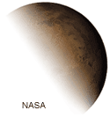
Use a wealth of data sets and technological tools to explore and understand features of Earth’s neighbor, the Red Planet. Look for and study the physical and chemical evidence of water and ice; compare erosion patterns on Mars and Earth; and make inferences about the planet's history as you study both its geologic features, including volcanoes and craters, and the physics of the atmosphere. Teach Next Generation Science Standards topics in Earth, physical, and chemical science integrating mathematics, in the context of Mars using recent data from Curiosity Rover and other missions.
Course content aligns with NGSS and helps build STEM activities into your science or math classroom. Participants will become confident in their ability to access and use data as a cutting-edge, engaging teaching tool.
| Use Mars and its real-time information as an exciting context to teach standards-based science concepts. |
Participants attend 5 LIVE, online sessions in a user-friendly format, which include, but are not limited to the following topics:
Session 1: Introduction and Mars Missions, a Historic Context
Session 2: Water on Mars and Changes on the Martian Surface Over Time
Session 3: Mars & Earth Science Topics Explored Together in NASA Imagery for Classroom Use
Session 4: Volcanoes on Mars and the Similarities with Earth
Participants engage in exciting and meaningful instructional design activities that are directly applicable to each educator's needs. Participants tailor assignments with course instructors to ensure greatest impact with students. Some may design a human habitat for Mars, incorporating math and engineering design; others may explore investigations of evidence of water on Mars using real-time data, for example. All participants receive access to a comprehensive web-based resource center on Mars data; extensive, peer-reviewed curriculum for K-12 classrooms, including reasons why water is no longer on Mars; and a simple-to-use viewers, including work with Google Mars to import Mars data and look for features including water in imagery.
Energy
Motion and Stability: Forces and Interactions
Earth's Place in the Universe
Matter and Its Interactions
Earth's Systems
Earth and Human Activity
Engineering Design
Remote Sensing, Atmospheric and Vapor Pressure, Density, Electromagnetic Spectrum, Geologic Time Scales, Glaciers, Global Climate Change, Maps (Topographic and Geologic), Meteorites, Ocean Topography, Rocks and Minerals, Soils, Topography and Elevation, Volcanoes, Water, Weathering and Erosion; Temperature, Phase Change of Matter, Electromagnetic Spectrum, Chemical Properties and Reactions, Water Cycle
Participants may implement course content and develop a portfolio following the guidelines of the National Board for Professional Teaching Standards, with the goal of submitting work for National Board Certification.
Educators may seek opportunities to present at conferences, or among colleagues and education community stakeholders. Course instructors and mentors will support your individual goals to become leaders in integrated STEM education.