Marine Science: The Dynamic Oceane-Tools
  Lesson Examples  Student
Resources
 Animal Movement
Maps and Data
 Contact
image of a sea turtle and a Bathymetry map
 Click here for Phase 1 resources.Click here for Phase 2 resources.Click here for Phase 3 resources.
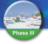
    Lesson 33: Changing Climate

         Back to Phase III Main Menu

Select a tab.
Thumbnail Name Credit Time File Type and Size
Coral Reef Interactive MapData credit: NOAA, National Environmental Satellite, Data, and Information Service (NEDIS)N/AHTML5 (6MB)
Bleaching Interactive MapData credit: NOAAN/AHTML5 (3MB)
Extension ActivityGreenhouse Gas Interactive Tool
U.S. Satellite Laboratory, NOAAN/AHTML5 (3MB)
Sea Change Excerpt VideoNOAA(1:49)MP4 Movie (14MB)
Sea Surface Anomaly Interactive MapData credit: NODC/NOAAN/AHTML5 (7MB)
California Sea Lion Interactive MapU.S. Satellite LaboratoryN/AHTML5 (N/A)


Media Figures Activity and Lab Worksheets Links


Disclaimer: "Online" access of e-Tools content is for home use only. e-Tools content from the Marine Science DVD must be pre-installed on school computers (single or networked). This will ensure that large files do not have to be downloaded on command. Large files will take time to download.


Copyright © 2024 U.S. Satellite Laboratory, Inc. All rights reserved.